Members attended Congress 2024

Representing B.I.G. Attend congress 2024

SEASCS 18th

Members attended the 18th SEA Survey Congress that was held in Manila, Philippines happened on August 15 for two days. alongside with the President, Tn. Hj. Md Don and members Pg. Matusin, Tn. Malik and Tn. Hadi

Tn. Hadi presented his paper on Sustainable Water Village in Brunei. 

AVA Congress 26th

26th ASEAN Valuers Association (AVA) Congress took place in Concorde Hotel, Singapore for two days from 4 November to 6 November 2024.

Members  Tn. Abd. Rahman, Nadthra and Hjh Hairaney attended the congress with other officers from other agencies.

Hjh Hairaney presented a topic “Challenges in Standardising the Profession of Real Estate Agents in Brunei” 

It focuses on estate agents in Brunei market context on viability with the process and clients needs.

CPD TALK 2025

CPD Talk 2025

CPD Talk was held at Dewan Betabur on August 4, 2025 Opening Remarks by Newas Ukoi and the invited guest speaker is Professor Peter Morgan from the University of Canberra, Australia on the topic :-

Climate Change: How it Affects the Land Surveying Profession.  

It is to see how Surveying can expand the technical abilities by using the technologies such AI tools at such climate change can be predicted at almost accurate data received as it can be.

B.I.G. 18th AGM 2025

18th B.I.G. AGM 2025

It was held in Higher Hotel attended by all members and welcoming the new members from all sections. The agenda is to recap the activities for the previous session and the plan for the upcoming years and election for the new council members.

Election of new council members for the session 2025-2027

  • President – Newasi Ukoi
  • Vice President – Warwick Newall
  • Secretary General – Abg Syazwan
  • Treasurer – Jason
  • —————————————————————————————————
  • Ex-officio – Hj Md Don
  • Assistant Secretary General – Dan Basrah
  • Assistant Treasurer – Hj Murni
  • Chairperson Land Surveying and GIS Mapping – Hj Zulfadly
  • Secretary – Hj Hifney
  • Chairperson Planners – Wafi Ramli
  • Secretary – Hj Khairul Hazmi
  • Chairperson Real Estate – Hjh Hairaney

Congratulations for the new members

  • Azizul Izam (M090)
  • Zulimin hj Hitam (M91)
  • Siew Chain Lim (A018)
  • Lai Yong Chan

May we strive for better and be the best for the nation future supporting the government vision

Survey Department and Brunei Institution of Geomatics(B.I.G.) Celebrate World GIS Day 2018

Survey Department and Brunei Institution of Geomatics(B.I.G.) Celebrate World GIS Day 2018

18 November 2018, Sunday, Bandar Seri Begawan – Survey Department, Ministry of Development Brunei Darussalam and Brunei Institution of Geomatics (B.I.G.) celebrated the World Geographical Information System (GIS) Day 2018 by hosting various games and activities on Sunday, 18 November 2018 during the Bandarku Ceria at the Taman Haji Sir Muda Omar ‘Ali Saifuddien, Bandar Seri Begawan. 

One of the main roles of B.I.G. is to promote and advance the science and application of geomatics for the advancement of the community as well as to educate and extend the technical and general knowledge in the field of geomatics. The World GIS Day is an important platform to gather professionals in geomatics and those who are interested to know more about the field. Various games and activities were organised whichaims to spread awareness of GIS to the public of all ages.

A public awareness program on the ‘Certified Plan (CP) Online’, a new online service by the Survey Department, was also organised.

14th South East Asia Survey Congress 2017 – Identification of borders, boundaries & house addresses in Brunei 16 August 2017

14th South East Asia Survey Congress 2017 – Identification of borders, boundaries & house addresses in Brunei 16 August 2017

AMONG the challenges faced by Brunei authorities in identifying borders of mukims and villages is that they overlap at some villages.

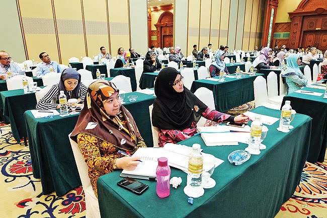
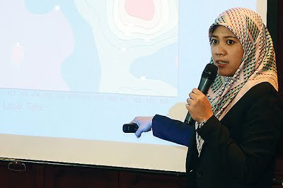
The issue was raised by Dayangku Hajah Hasnaliati binti Pengiran Setia Jaya Pengiran Haji Abdul Momin, a representative of the Survey Department, during her presentation on ‘Mukim and Village Borders’ at the 14th Southeast Asia Survey Congress (SEASC) held at The Rizqun International Hotel yesterday.

“Factors such as rapid developments in the country, and changes in the population density, also require the demarcation line to be readdressed,” she said, adding, “The proper and accurate identification of borders is crucial for the administration of mukims, villages and their residents, as well as in the designation of a house or building address and other matters.”

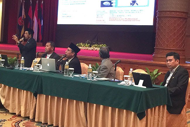
Dayangku Hasnaliati also explained that the Survey Department manages the taskforce committee which identifies boundaries for villages and mukims in Brunei, including borders for municipal areas.

The taskforce is also responsible for addressing issues raised by members of the public with regard to boundaries or perimeters.

She also announced the publication of several guide books that were produced as a result of collaborative efforts with the taskforce committee members, mukim penghulus and village heads.
“A total of six guide books were published from November 2008 until 2012, and the books can be purchased at the Geomatics Information Centre (PMG) on the second floor of the Survey Department,” she said.
Several other topics were raised during the congress, including a talk on house address schemes in Brunei, presented by Hajah Nona Lieza binti Haji Yahya from the Survey Department.
Her presentation dealt with the differences between house address schemes on land and in Kampong Ayer, where the residences may also include the numbers of bridges.
With the theme of ‘Bridging the Gap’, the 14th SEASC 2017 aims to be a platform for the sharing of ideas and best practices in the interests of communities within the region, while adopting and advancing various conformance issues in a meaningful and productive manner for the mutual benefit of all Asean member countries.
14th South East Asia Survey Congress 2017 – Densification of GNSS/GPS Network 16 August 2017

14th South East Asia Survey Congress 2017 – Densification of GNSS/GPS Network 16 August 2017

IN A move to densify the nation’s GNSS/GPS Network, the Geodetic Section of the Survey Department, Ministry of Development conducted a simulation for a Field Reconnaissance Project at several key locations around the Sultanate.
The final list comprised 15 out of 19 proposed sites for the project using Primary Order Network which covers an area within 25 kilometres – two areas were delayed due to technical difficulties while the remaining two were ruled-out due to not meeting the quality criteria.
This was highlighted by Abdul Khaliq bin Haji Bujang from the Brunei Survey Department during a parallel session on Surveying and Mapping held in conjunction with the on-going 14th Southeast Asia Survey Congress 2017 at The Rizqun International Hotel, Gadong yesterday.
The survey was conducted by a project team led by the Geodetic Section of the Survey Department with testing procedures conducted using equipment based on the started regulations of geomatics (Work Instruction Geodetic 2016).
The field reconnaissance project used levelling mount and GPS antenna secured to a stainless steel pin which is anchored within the top pillar which is generally simple and easy to construct almost in every terrain.
Results show that the most important factors for the successful survey focussed on collaboration to develop and improve the task standards in accordance with international standards applied consistently. According to Abdul Khaliq, the task design and implementation was “well-planned” using technological, spatial data computational and surveying viewpoints as well as consistent reviews and updates that were also factors to the success.
Abdul Khaliq bin Haji Bujang from the Geodetic Section, Survey Department
sharing data collected from the recent survey.
However, in establishing operating and maintaining the good and reliable network that can serve to meet all the objectives, there are several challenges and limitations that have to be properly taken into considerations.
“The reliability of the GNSS/GPS network will strongly depend on good and realiable communication. It also requires professional working culture and also good support from dedicated and professional team in order to maintain the whole system, to process the collected data and analyse the obtain results for various applications and interest.
“Most lands covered are private lots (land parcel), therefore thorough investigation should be conducted to build a permanent monument for a primary network,” he explained.
The network systems have become an important tool for surveying where users can obtain accurate date either from control surveying, cadastral surveying, topographic surveying, engineering surveying, mine surveying and even hydrographic surveying.
The consideration and approval for the project has been made. Abdul Khaliq believes that the network will help for better accuracy and precision, and increase in revenues.
Article & Photo Courtesy of Borneo Bulletin
14th South East Asia Survey Congress 2017 – Brunei Climate Change 16 August 2017

14th South East Asia Survey Congress 2017 – Brunei Climate Change 16 August 2017

CLIMATE change due to global warming has impacted countries globally and Brunei Darussalam is no exception.
According to data collected by the Brunei Darussalam Meteorological Department, the Sultanate is getting wetter and warmer.
On average, Brunei’s maximum tempera-ture is going up by +0.3 degrees Celsius with mean temperature increasing by 0.6 degrees Celsius while the annual rainfall is showing a rising trend, with the mean rainfall increasing to 37.2mm.
The data recorded at the BIA Observational Station was revealed by Harnina Morani from the Meteorological Department in her presentation on Brunei’s climate during a parallel session of the 14th Southeast Asia Survey Congress (SEASC) 2017, held at The Rizqun International Hotel recently.
Showing charts and graphs of the increase in rainfall, Harnina Morani explained that the “recent trend shows significant increase in rainfall from January to April and slight increase from June to August. The months of January to April are getting wetter in recent years.
“The annual total rainfall is showing an increasing trend. There is a significant increase from 2006 to 2011 and the recent trend shows a mean rainfall of 37.2mm,” she said.
Meanwhile, she highlighted that Brunei was affected by strong El Nino years – 1982-1983, 1997-1998 and 2015-2016, while 2009-2010 was a moderate El Nino year. The maximum temperature tends to peak during El Nino years.
Harnina Morani from the Brunei Darussalam Meteorological Department
during her presentation
“Monthly maximum temperature has shown a slightly increasing trend during recent years (2013-2016), particularly from August to January. Monthly variation from the highest and lowest maximum temperature is about two degrees Celsius.”
Harnina Morani revealed that from 1978 to 2016, Brunei’s maximum temperature is warming by +0.3 degrees Celsius on average. The mean temperature from 1981 to 2013 shows that Brunei’s temperature is warming up by 0.6 degrees Celsius.
“This (data) shows that climate change is having an impact on Brunei as well,” she added.
Harnina Morani highlighted that in 2016 Brunei witnessed a weird weather pattern because of the El Nino phenomenon. The year saw the lowest ever rainfall recorded in the Sultanate at 1,900mm compared to the country’s annual rainfall of 3,000mm.
The monsoon season in the country has also seen a shift, she said. The northeast monsoon started at the end of December while the inter monsoon began in middle April and southwest monsoon started in late July until November.
“These calculations are based on data from a single station which represents Brunei,” she said, adding that “there is a need for more stations to give a better representation of Brunei Darussalam”.
Article & Photo Courtesy of Borneo Bulletin
14th South East Asia Survey Congress 2017 – Closing Ceremony 17 August 2017

14th South East Asia Survey Congress 2017 – Closing Ceremony 17 August 2017

THE 14th Southeast Asia Survey Congress (SEASC) 2017 ended yesterday morning with a closing ceremony attended by Haji Muhammad Lutfi bin Abdullah, Permanent Secretary (Administration and Finance) at the Ministry of Development.
Pengiran Haji Matusin bin Pengiran Haji Matasan, the Director of 14th SEASC 2017 in a speech expressed his appreciation to the organising committee, participants, volunteers and the local media as well as other stakeholders for the success of the congress.
Pengiran Haji Matusin revealed that 20 papers were delivered by speakers from Brunei Darussalam in this year’s congress.
Pengiran Haji Matusin, who is also the President of Brunei Institute of Geomatics, said, “We hope that the congress had lived up to its theme – Bridging the Gap – physically and spiritually. Realistically, we would have narrowed the gap in terms of our understanding of the various issues facing us. On the regional front, the realisation of Asean Free Trade Agreement certainly should spur us to conclude as many Mutual Recognition Agreements as possible.”
Handing over of the Southeast Asia Survey Congress flag
by Haji Ali Bakar bin Haji Kasim, Surveyor General to Peter Barratt
Handing over of the Southeast Asia Survey Congress flag
by Haji Ali Bakar bin Haji Kasim, Surveyor General to Peter Barratt
Pengiran Haji Matusin bin Pengiran Haji Matasan,
President of Brunei Institution of Geomatics making a speech.
On the domestic front, as Bruneians and as geomaticians, he said, “We hope to continuously contribute towards nation building, in particular to realise Vision 2035.”
The highlight of the ceremony saw Haji Ali Bakar bin Haji Kasim, Surveyor General who is also the congress chairman handing over the SEASC flag to the next host, Darwin of Australia, which was received by Peter Barratt. The event was witnessed by the guest of honour.
The handing over of the flag symbolised the end of the 14th SEASC 2017 and beginning of preparations for 15th SEASC in 2019.
Over the three days of the 14th SEASC 2017, over 300 participants from Brunei and overseas attended the event with over 70 papers delivered for deliberation.
Article & Photos Courtesy of Borneo Bulletin
14th South East Asia Survey Congress 2017 – New Techniques for Moon Sighting 16 August 2017

14th South East Asia Survey Congress 2017 – New Techniques for Moon Sighting 16 August 2017

TWO working papers on the use of modern technology for the sighting of crescent moon (Hilal) were presented during the Falak Syar’ie parallel session at The Rizqun International Hotel, Gadong yesterday.
The parallel session was part of the 14th Southeast Asia Survey Congress (SEASC) 2017 organised by the Ministry of Development’s Survey Department, in collaboration with the Brunei Institution of Geomatics (BIG), under the auspices of the Asean Federation of Land and Geomatics Survey (AFLAG).
In his presentation on ‘Imaging Method for Crescent Moon Sighting with the Charge Couple Device (CCD)’, Haji Julaihi bin Haji Lamat, from the Brunei Institute of Geomatics, introduced the CCD as a technology that was born in 1969 at the AT&T Bell Labs, and has since undergone vast improvements with modern software.
“Today, knowledge has advanced, because not only can the crescent moon be sighted accurately, with the help of a telescope and the image capture method, but processed records of the moon sighting can be reviewed without the need for eye witnesses,” he said.
The start of Ramadhan, Syawal, and Zulhijjah are normally determined through the Ruqyah method of sighting the crescent moon with the naked eye after sunset. When the new crescent is sighted, it will mark the beginning of a new month in the Islamic calendar.
Haji Julaihi bin Haji Lamat, from the Brunei Institute of Geomatics, during his presentation on ‘Imaging Method for Crescent Moon Sighting with Charge Couple Device (CCD)’.


In defining a successful sighting, there is still a difference of opinion among religious scholars, because the Hadith or traditions of Prophet Muhammad (pbuh) particularly emphasise eyewitness testimony or the application of knowledge.
“Knowledge can be defined as knowing the position of the crescent moon through astronomical calculations, in addition to use of modern technology such as imaging or video recording,” said Haji Julaihi, adding that previous experiences have shown that CCD assistance on telescope is more effective in the early sighting of the crescent moon after sunset.
Records show that the crescent moon for 29th of Ramadhan, 1425 Hijrah, corresponding to November 13, 2004, was sighted at 19 hours and 13 minutes, while 1st of Syaaban, 1437 Hijrah on May 7, 2016, was sighted much earlier at 14 hours and 57 minutes after sunset with a light illumination of 0.6 per cent.
Meanwhile, Hazarry bin Haji Ali Ahmad from the Astronomical Society of Brunei Darussalam in his presentation, ‘New Moon Imaging Technique Using Digital Cameras in Brunei Darussalam’, said that new moon data can be difficult to obtain, owing to certain factors such as astronomy, meteorology and psychology.
“Therefore, moon sighting in the present age will often employ astronomical instruments such as a telescope equipped with a DSLR digital camera, when the light is at a minimum,” he said.
Article & Photos Courtesy of Borneo Bulletin

New techniques for moon sighting explained