IN A move to densify the nation’s GNSS/GPS Network, the Geodetic Section of the Survey Department, Ministry of Development conducted a simulation for a Field Reconnaissance Project at several key locations around the Sultanate.
The final list comprised 15 out of 19 proposed sites for the project using Primary Order Network which covers an area within 25 kilometres – two areas were delayed due to technical difficulties while the remaining two were ruled-out due to not meeting the quality criteria.
This was highlighted by Abdul Khaliq bin Haji Bujang from the Brunei Survey Department during a parallel session on Surveying and Mapping held in conjunction with the on-going 14th Southeast Asia Survey Congress 2017 at The Rizqun International Hotel, Gadong yesterday.
The survey was conducted by a project team led by the Geodetic Section of the Survey Department with testing procedures conducted using equipment based on the started regulations of geomatics (Work Instruction Geodetic 2016).
The field reconnaissance project used levelling mount and GPS antenna secured to a stainless steel pin which is anchored within the top pillar which is generally simple and easy to construct almost in every terrain.
Results show that the most important factors for the successful survey focussed on collaboration to develop and improve the task standards in accordance with international standards applied consistently. According to Abdul Khaliq, the task design and implementation was “well-planned” using technological, spatial data computational and surveying viewpoints as well as consistent reviews and updates that were also factors to the success.
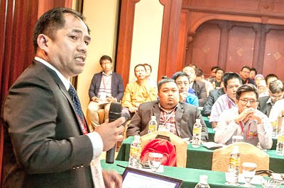
Abdul Khaliq bin Haji Bujang from the Geodetic Section, Survey Department
sharing data collected from the recent survey.
However, in establishing operating and maintaining the good and reliable network that can serve to meet all the objectives, there are several challenges and limitations that have to be properly taken into considerations.
“The reliability of the GNSS/GPS network will strongly depend on good and realiable communication. It also requires professional working culture and also good support from dedicated and professional team in order to maintain the whole system, to process the collected data and analyse the obtain results for various applications and interest.
“Most lands covered are private lots (land parcel), therefore thorough investigation should be conducted to build a permanent monument for a primary network,” he explained.
The network systems have become an important tool for surveying where users can obtain accurate date either from control surveying, cadastral surveying, topographic surveying, engineering surveying, mine surveying and even hydrographic surveying.
The consideration and approval for the project has been made. Abdul Khaliq believes that the network will help for better accuracy and precision, and increase in revenues.
Article & Photo Courtesy of Borneo Bulletin