
BRUNEI is hosting the seventh Annual Multi Global Navigation Satellite System (GNSS) Asia Conference today with the objective to establish industry collaboration with local companies.
The conference which is scheduled to run until December 9 will be held in the capital, where 100 specialists from over 10 countries, including Brunei, will present various topics on the Quasi-Zenith Satellite System (QZSS), a multipurpose satellite based on an augmented system; the integration of satellite positioning technology in emergency medical services and innovative space-based applications using GNSS among others.
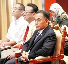
The Minister of Primary Resources and Tourism Yang Berhormat Dato Paduka Hj Ali Hj Apong was present yesterday as one of the participants in a seminar titled ‘Agriculture of Brunei Darussalam’ presented by Dr Diana Dennis, Senior Livestock Husbandry Officer from the Department of Agriculture and Agrifood.
The conference was supported by the Ministry of Primary Resources and Tourism, and the Survey Department under the Ministry of Development.
Speaking to The Brunei Times on the sidelines of the conference, at the Rizqun International Hotel, Space.Tec Partners Managing Partner Rainer Horn said the conference aimed to introduce companies in Brunei on how to use satellite communications systems.
“The conference hoped to include Brunei as one of the country members in the Southeast Asia region, to discuss about the existing challenges in using satellite system, for example in emergency situations, traffic congestions, monitoring weather patterns with GNSS and others,” said Rainer. “This conference is held to bring a unique specialist industry community to Brunei,” he said.

Meanwhile, European Global Navigation Satellite Systems Agency (GSA) Market Development Officer, Justyna Redelkiewicz-Musial, said she hoped to introduce the Galileo satellite system and EGNOS satellite navigation, where these systems can provide users with a freely accessible service for positioning, navigation and timing.
“We have not met any Bruneian industry using the satellite system. We hope to get networking here during the conference,” she said. She said that Bruneian government could benefit from using the satellite systems on the ground in such areas as precision agriculture, mapping, road and rail applications.
Article & Photos Courtesy of Brunei Times