UTAP Seminar – 14 November 2012

UTAP Seminar – 14 November 2012

The Permanent Secretary (Administration and Finance) at the Ministry of Development, Awg Hj Muhammad Lutfi bin Abdullah has underlined the fundamental importance of geospatial development in the role it plays in the development of the nation.

He was speaking at the opening session of the Basic Land Surveying Seminar Development (UTAP) based on the theme ‘Geospatial for Sustainable Development’ that was organised by the Survey Department and supported by the Brunei Institute of Geomantics (BIG), at the Rizqun International Hotel on Wednesday (14 November 2012).

The information extracted from the analytical information is a foundation for construction projects, and the relevance is high for those involved, such as stakeholders, in making decisions that are fast, accurate and effective, he further explained.

Awg Hj Muhammad Lutfi added that the technology utilised in the analysis has various aspects such as in environmental disasters, land usage, planning and others.

He added that the Survey Department has prepared geospatial information for nation-building purposes such as aerial photographs, LIDAR (Light Detection and Ranging), topographical maps and more.

The information, he said, has been compiled into the Survey Spatial Data Infrastructure (SSDI) launched the previous month and furthermore the Ministry of Development will integrate the information with other departments under the ministry before disseminating it to other government agencies. The completed system will be called the National Spatial Data Infrastructure.

Consequently, he urged all government agencies to work closely together in the sharing of geospatial information, such as disseminating the information to the general public and stakeholders through meaningful dialogues and discussions.

Earlier, the Acting Surveyor General of the Survey Department, Awg Hj Ali Bakar bin Hj Kasim said that nine working papers will be presented by the participants. He said that such information should be shared between relevant agencies for further utilisation according to needs, and underscored the importance to keep abreast with the latest technology.

The President of the International Federation of Surveyors (FIG), Mr Teo Chee Hai also said his organisation is focussed on ways to collaborate and to ensure that the disciplines of surveying meet the stated requirements. He further elaborated on the usage of geospatial information in devices such as geographical and temporal context.

The seminar was aimed at introducing new projects launched by the Survey Department, to identify projects in development by other government agencies, dissemination of geospatial information and the sharing of invaluable experiences amongst the participants.
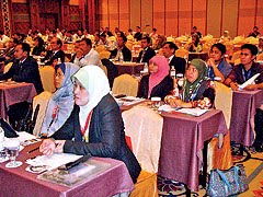
Attendees at the Seminar


Organised every two years, the UTAP seminar began in 1985 and this year’s session was held in conjunction with the Survey Department’s 60-year anniversary.

The seminar encompassed two sessions. The first session was entitled ‘Geospatial Readiness’ and was facilitated by Awg Newas bin Ukoi, while the second session was entitled ‘Geospatial Application’ and was facilitated by Pg Hj Matusin bin Pg Hj Matasan.

Source: Borneo Bulletin – 15 November 2012

FIG Commission 7 Annual Meeting 2011 – 25 September to 01 October 2011

FIG Commission 7 Annual Meeting 2011 – 25 September to 01 October 2011

FIG Commission 7 Annual Meeting 2011 and International Symposium „Cadastre 2.0“

25 September – 1 October 2011, 

TBI Grillhof, Innsbruck, Austria

Introduction

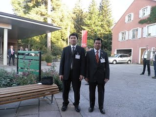
Representative from Brunei Darussalam :

Hj Ali Bakar Hj Kasim (Deputy Surveyor General,  Survey Department) 

Hj Junaidi bin Hj Yunos (Senior Land Officer, Land Department)


FIG Commission 7 held his annual meeting from Sept. 26th to 30th 2011 in the wonderful city of Innsbruck, Austria. This very successful event culminated with the high level International Symposium Cadastre 2.0. This meeting welcomed delegates from 

30 countries among them FIG Vice President Professor Chryssy Potsiou, former Chairs of Commission 7 Andrzej Hopfer, Ian Williamson, Paul MunroFaure andAndrás Osskó. Without any doubt, issues related to land administration and cadastral perspectives are still of very high interest, namely in regard of citizens’ involvement, crowd sourcing and social medias. And to completion of cadastre and land registration in the developing world, this concerns about 75% of the 6 billion or so spatial units in use by humans on the planet.

Group photo visiting the Construction Lower Inn Valley Railway Site


Issues Discussed

  • The future of cadastre is high on the agenda of the FIG Commission 7. Jürg Kaufmann and Ian Williamson shared their thoughts with the Commission.
  • Many discussions about one hand the need for a AAA Cadastre (Accurate, Authoritative, Assured) for the some advanced countries and on the other hand, the immediate need for low cost solutions to meet the challenge of population in developing countries. There are different opinions and solutions.
  • Developments of 3D cadastre have been discussed. This will be one of the important attention points in the work of the Commission, as well as management of government lands, pro poor land tools (with UN-HABITAT), spatial enabled societies, climate change, the cadastral template and the ISO Land Administration Domain Model.
  • There was a contribution on the European Measurement Code for the floor and area of buildings and in general attention to condominium rights with cases from Italy.
  • The technology will take over the work of surveyors in land registration more and more. This work can be done by many people based on a very short education. We will not see cadastral surveyors in the field so much in the future.
  • Surveyors’ role and contribution to land administration is under change from field surveys to information and quality management of spatial data and being supportive and leading in developments of national spatial data infrastructures with a broad application range. This can only be done in close co-operation with professionals from other disciplines. Reliability of data is the key contribution of our profession.
  • It will be possible that people develop their own cadastre based on infrastructures as Google and Facebook.
  • Developments of cadastral systems in Asia; e.g. Malaysia and Korea are very impressive; also in support of huge land reforms.
  • Our colleagues from Africa need support for their actions in relation to their governments. FIG will not take a position in political discussions, but will provide alternative approaches, checklists in implementation alternatives – e.g. in relation to land grabbing as it can be observed in many countries; in co-operation with FAO.
  • Disaster management and importance of cadastre was discussed. An example from Hungary illustrated the need of combining data from different sources in case of disaster.
  • Impact of earth quakes and tsunamis for cadastre was discussed with cases from Japan and New Zealand. Rapid relief based on cadastral information.
  • A very interesting visit to the BEV Cadastral Office of Kufstein. Austria was one of the very first countries with a digital cadastre and land registration. Public can view the cadastral data and purchase on line.
  • A very impressive guiding tour of the Construction of the Lower Inn Valley Railway Tunnel Site. Delegates had opportunity to see the construction of the 25 m underground railway tunnel.
  • There is an urgent need for knowledge and information on the latest developments in cadastre and land registry in many countries; the work of the commission (reports, cadastral template, proceedings) are used for this purpose. This could be even better communicated. And the link with Géomètres sans Frontières to be strengthened; a challenge for the young generation of surveyors.
  • Commission 7 wants to thank the Austrian Society for Surveying and Geoinformation and more specifically Mrs Gerda Schennach, Vice-Chair of Commission 7, for organizing such a perfect meeting.
Technical Visit to the Construction Lower Inn Valley Railway Site


Technical Visit to the BEV Cadastral Office of Kufstein

Robin McLaren speaking at the International Symposium Cadastre 2.0


Findings / Recommendation.

  • The meeting was very useful for the senior officers from both Survey and land departments of Brunei Darussalam to attend, as issues raised on the land management from the members countries were discussed during the meeting.  
  • As a member of the FIG , Survey Department, Ministry of Development,  Brunei Darussalam shall update the current achievement of the Cadastral activities in the country via the FIG  commission 7 website.
  • In the next meeting the representative of Brunei Darussalam shall present the current status of cadastral activities in this country. Field to Finish (F2F) project which is currently in the process of implementation is one of the subjects that will be reported in the future meeting.
  • During the working group discussion, it was emphasized that cadastral management (land development policy) play important role in disaster management. For instance, proper scheming for the land subdivision will at least educate people to develop their land properly in accordance to building or construction guidelines.
  • Brunei Darussalam is currently embarking coordinated cadastral System project. The project is expected to be completed in stages. Once the project has been completed, the survey data acquisition will be much faster and much cheaper. This will improve the cadastral system in this country.
  • Cadastral data sharing between Survey Department, Land Department and other related agencies within the Ministry of Development shall be implemented in the near future. This will expedite the process of decision making.
  • All the delegates had an opportunity to visit the state boundary between Austria and Germany. The boundary marks were planted on top of the hills and were maintained properly.
Technical Visit to the state boundary between Austria and Germany


Conclusion

The FIG commission 7 meeting was very successful event culminated with the high level International Symposium Cadastre 2.0. The issues discussed related to land administration and cadastral perspectives are still of very high interest, namely in regard of citizens’ involvement, crowd sourcing and social medias and to completion of cadastre and land registration in the developing world, this concerns about 75% of the 6 billion or so spatial units in use by humans on the planet.  Many discussions about one hand the need for an AAA Cadastre (Accurate, Authoritative, and Assured) for the some advanced countries and on the other hand, the immediate need for low cost solutions to meet the challenge of population in developing countries. There are different opinions and solutions. Surveyor’s role and contribution to land administration is under change from field surveys to information and quality management of spatial data and being supportive and leading in developments of national spatial data infrastructures with a broad application range. This can only be done in close co-operation with professionals from other disciplines. Reliability of data is the key contribution of our profession.  There is an urgent need for knowledge and information on the latest developments in cadastre and land registry in many countries.

Submitted by: Hj Ali Bakar Hj Kasim (Acting Surveyor General, Survey Department) 25